Road travel has long been one of the most romantic forms of travel. Especially the American incarnation of it, all those desert landscapes and seascapes that reveal a vast country of 50 states and countless moving parts. A week (or two) behind the wheel is the best way to enjoy the United States since Americans themselves almost invented the idea – if not when Henry Ford launched the Model T in 1908, then certainly amid the post-war optimism of the fifties, when Route 66 became a holiday highway to the west, taking domestic tourists to the Grand Canyon and the Pacific Coast.
Here we break down the various “whats,” “wheres,” and “whens” of classic U.S. travel – what to do to make your trip the best it can be; where to go for different types of scenery, geography, or experiences; when to see certain regions at their best.
Best routes
Route 66
The perception of Mother Road as a playground for life-affirming road trips probably exceeds the reality of the vacation. First, it’s awfully long – 2,448 miles from its starting point in Chicago to its California terminus on the beach in Santa Monica; it would take you at least two weeks to cover every mile. Second, the eight states it crosses have distinct neighborhoods that – with humble apologies to Oklahoma and Kansas – can be flat and impersonal. Third, it’s more memory than reflected fact on a map; Route 66 has existed as a series of “other” interconnected freeways since its official number was removed from the U.S. highway system in 1985. But as a slice of the American soul, it still radiates drama and discovery, especially if you confine yourself to the four desert states (Texas, New Mexico, Arizona, California) that frame the western half of the route.
State Route 1
The ribbon of asphalt that hugs 656 miles of California’s Pacific Coast is so famous that it’s odd to call it anything other than “Highway 1.” But whatever its official name, this winding wonder should be on every traveler’s to-do list. You don’t have to drive all of it to get the gist of it. The southernmost stretch to Dana Point will have you idling in heavy Los Angeles traffic; as you approach Leggett, which is on the opposite end of the road, you might want something noisier than the forested quiet of northern California. But stick to the “greatest hits” section (485 miles from San Francisco to Long Beach via Monterey, Big Sur, Santa Barbara, and Malibu), and you won’t go wrong: cliffs rise on one side and the ocean on the other.
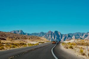
US Route 160
There is a mathematical symmetry in the way Arizona claims a precise 160 miles of the 1,465-mile U.S. Route 160 that crosses it from northeast to southwest. By themselves, those 160 miles aren’t particularly dramatic, they cut across a barren landscape of dust and dirt; the American West at its most colossal, an air of desolation punctuated only by the occasional gas station or two-horse settlement. But it’s the places that complete the journey that make this road worth the drive. Monument Valley, located 20 miles north of Kaenta, near the northeast corner of the state; the northeast corner itself belongs to the Four Corners Monument, where Utah, Colorado, New Mexico and Arizona meet. The masterpiece, however, is 75 miles from Tuba City, the western terminus of Route 160. The Grand Canyon, timeless in its grandeur.
Blue Ridge Parkway
While the diverse mountain ranges of the West – particularly the rugged barrier of the Rocky Mountains – have endless appeal for photography, the other side of the American landscape also has its peaks and photogenic aura. A prime example is the Appalachian Mountains, stretching northeast from Alabama to Maine before crossing the border into Canada. Within is a series of foothills, each worthy of a visitor’s attention – the Great Smoky Mountains of Tennessee, the broader Blue Ridge Mountains, which also extend through the Carolinas and Virginia. Here, the Blue Ridge Parkway is the hero of the road trip, stretching 469 miles between the Great Smoky Mountains National Park (Tennessee) and the equally forested Shenandoah National Park (Virginia). It offers great recreation in the spring and summer, but it looks best in the fall when the “fire” breaks out.
Lake Michigan loop
Lake Michigan isn’t the largest of the five Great Lakes, but it’s the easiest to bypass entirely; it’s the only member of the quintet that skirts the Canadian border to set up completely on American soil. Of course, “easiest” requires a certain amount of skill. Circumnavigating around Lake Michigan is no easy task. It’s 900 miles and – if you want to sightsee at a leisurely pace – two weeks on the road. But in the meantime, the lake’s scenery, at least outside the cities along the coast (Chicago in Illinois, Milwaukee and Green Bay in Wisconsin), has the simplicity of rural America, with its orchards, sand dunes and small-town liveliness, most notably on Wisconsin’s Door Peninsula and the refined version of Michigan that forms the eastern side of the lake. Meanwhile, the Straits of Mackinac is a joy: the place where Lakes Michigan and Huron meet under a classic suspension bridge.